Transform
Transform |
Description |
Here the keyword *TRANSFORM and its corresponding parameters are described. This is used to define local coordinate systems which can for example facilitate definition of boundary conditions (e.g. normal displacement to a tilted surface).
|
| TRANSFORM Transform coordinate system |
Usage |
|||||||||||||||||||||
|
|||||||||||||||||||||
Description |
|||||||||||||||||||||
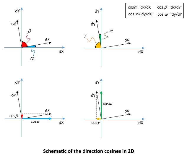
Defines a local coordinate system for the assigned node set. This data structure will be used to create ParaGeo Coordinate_system and Transformed_freedoms data structures. Following the keyword *TRANSFORM and all its corresponding parameters the direction cosines of the new coordinate system should be defined in a comma separated value as shown below.
•Direction cosines in 2D:
•Direction cosines in 3D:
Examples
|
|||||||||||||||||||||

