Rest_002 Restoration to forward: a normal fault model

Contents
The ParaGeo restoration data output can be used to generate input data for a forward simulation. After each restoration step, ParaGeo automatically outputs a .geo file with name "DataFileName_FormationName.geo" with data that helps to generate the following input for the forward simulation using different ParaGeo utility data structures:
Pre-existing sediment geometry
The geometry for the pre-existing sediment in the forward simulation can be obtained from the final configuration of the restoration. This information is stored in the last .geo file output from the restoration.
Boundary conditions for the forward model
The boundary conditions (displacements) for each control stage of the forward simulation are obtained by reversing the boundary displacements obtained from the corresponding restoration step. The boundaries need to be defined as geometry_sets to facilitate boundary identification for processing of the data during restoration to forward conversion. When conversion is performed a part_geometry_set is created for each model boundary. The name convention for the generated part geometry sets associated to each boundary geometry set is "GeometrySetName_pg". Such part geometry will be used to drive the displacements in the forward simulation. Different methods may be used to apply the displacements to the model boundaries during forward simulation:
i.Definition of a contact relationship between the model boundaries and the corresponding part geometry sets
ii.Prescribing the boundary displacements from the part geometry sets using Prescribed_boundary_data . The boundaries may be either fully prescribed or prescribed in the normal direction only
iii.The side boundaries may also be defined vertical with the motion defined by the displacement in the basal boundary
It is noted the methods may be combined (e.g. the displacements in the basal boundary may be defined via contact whereas the side boundaries may adopt a normal prescribed displacement)
Sedimentation horizons
Sedimentation horizons are defined directly from the restoration surface. The deposited sediment volume in the forward simulation will depend on the accommodation space (relative position of the sedimentation horizon and current top surface) generated due to the prescribed displacements and sediment compaction during previous control stage.
Fault propagation pathways
Fault geometry in restoration can be defined as fault_sets. This facilitates later identification and processing of the fault data. Thus fault geometry is tracked at each restoration step and printed to a part_geometry_set for each fault. Then during forward simulation faults can be propagated into new sediments following the fault path defined via the part_geometry_set.
This tutorial example aims to demonstrate how to perform a geomechanical-based restoration in ParaGeo which includes faults that can be identified as fault sets and then generate a forward model from restoration output. A normal fault model involving three formations cut by a single fault is used for that purpose. The total model length is 6 km and height of 1.7 km.
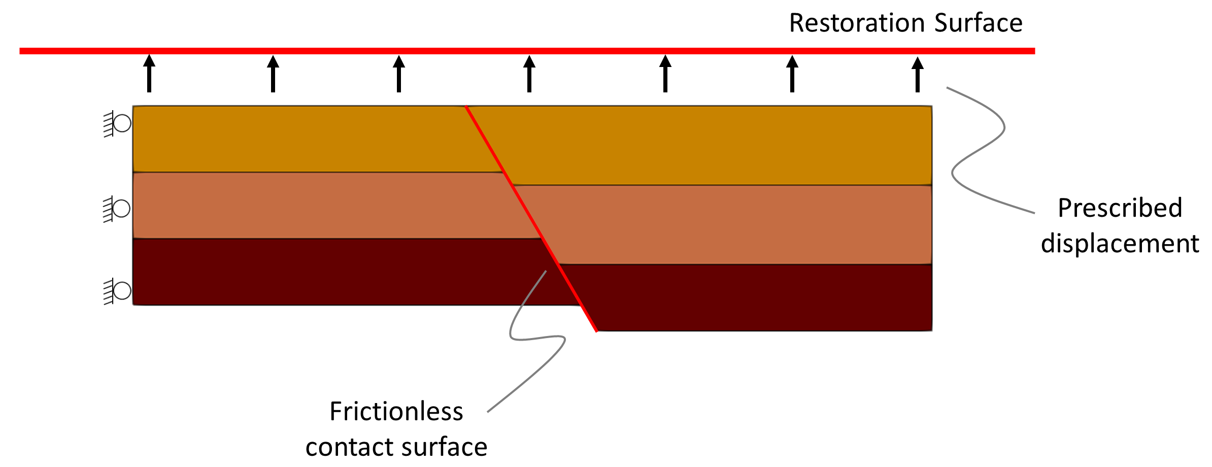
View of the model geometry and boundary conditions.
Specific issues considered in this tutorial example are:
1Set up of a geomechanical restoration in ParaGeo
2Definition of contact data for faults on restoration
3Definition of fault set data
4Generation of forward simulation data file from restoration results
5Fault insertion on newly deposited units during forward simulation
Simulation Cases
Step 2 Forward create data file
Step 3 Generated Forward simulation data file